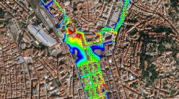
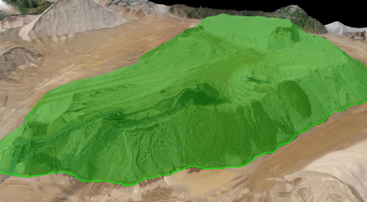
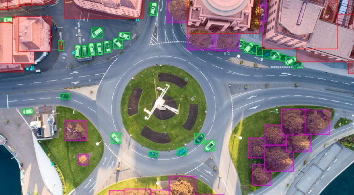
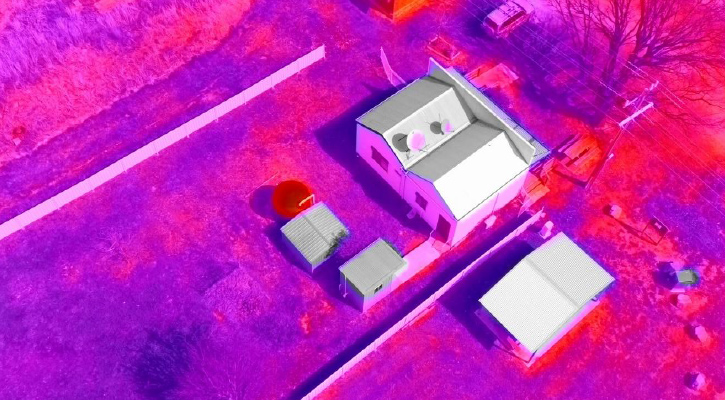
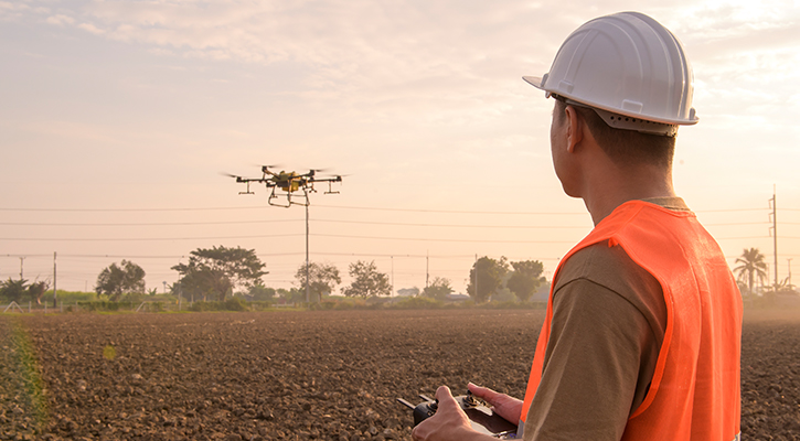
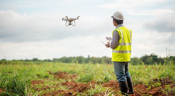
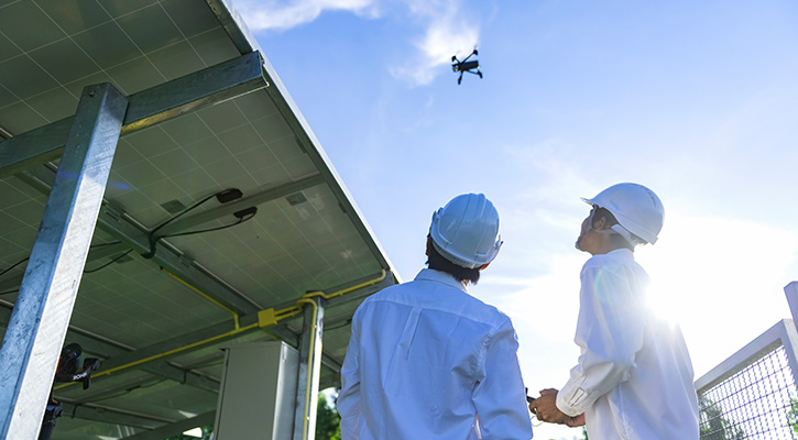
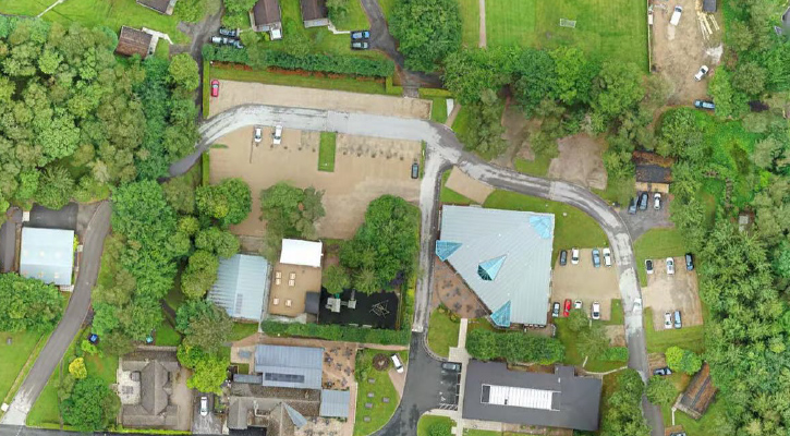
Drone Surveys

REAL TIME & ACCURATE REMOTE AREA INSPECTION

At MediaSense, we've always believed in the power of storytelling to connect people with purpose. For over 15 years, our Ahmedabad based video production agency has specialized in crafting compelling promotional films that bring products and services to life, helping businesses worldwide resonate with their audiences. Now, we're taking our commitment to innovation to new heights by expanding our expertise into advanced drone solutions.

Drone Surveys

WHERE WE CAN USE !

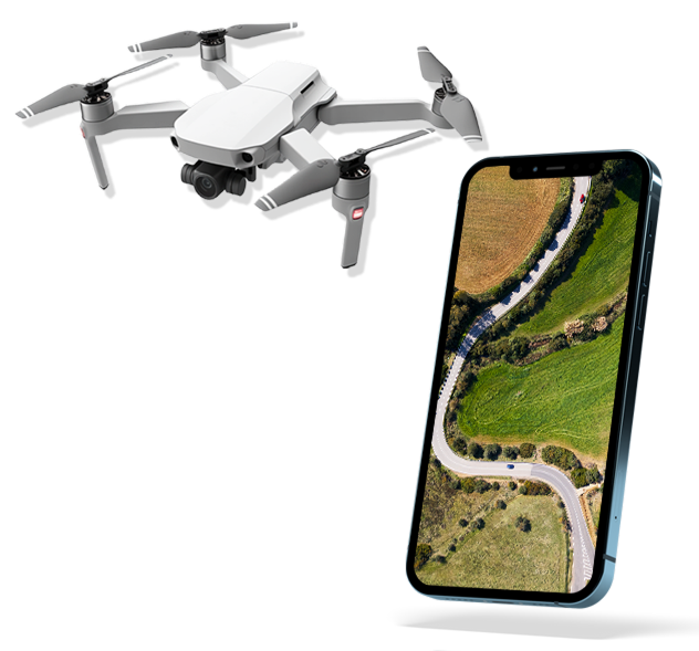
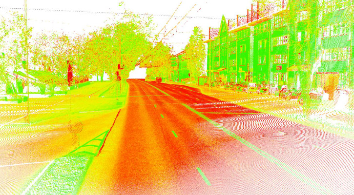
This evolution allows us to seamlessly integrate our narrative prowess with cutting-edge aerial technology. MediaSense is now also India's premier provider of drone solutions for diverse industrial applications, including surveying, mapping, construction, agriculture, and surveillance. Our dedicated in-house design and software development teams create bespoke drone solutions, while our robust R&D center continually explores future technologies. With a comprehensive platform integrating advanced tools, experienced trainers, and dedicated service providers, we deliver unmatched reliability and performance, offering solutions precisely tailored to your unique needs. We're excited to offer an unparalleled blend of visual storytelling and high-precision aerial data, empowering you to connect, visualize, and innovate like never before.

Our Mission

To transform images into actionable intelligence, enabling smarter decisions through precision algorithms and timely insights.

Our Vision

To convert raw data into clear, actionable insights precisely when needed.

Our Values

Innovation, integrity, safety, and client-centric delivery.

Our Work

What We Do !

Land Survey

Drone land surveying, uses drones equipped with cameras and sensors to capture data for creating maps and 3D models of land areas.

  • Land Survey
  • Mining Survey
  • Road Survey
  • Railway Survey
  • Solid Waste Survey
  • City Survey
  • Canal Survey
  • River Survey
  • Property Survey

Construction

Construction surveying involves using measuring techniques to provide dimensional control during all phases of construction, from planning to completion.

  • BuildingConstruction
  • RailwayConstruction
  • EarthworkTracking
  • As-BuiltComparisons
  • Tasks&Schedules
  • Warehouseconstruction
  • ShipConstruction
  • MetroConstruction
  • RoadConstruction
  • BridgeConstruction

Agriculture

Drones can create detailed maps of agricultural fields, including crop types, boundaries, and variability within fields.

  • FarmSurvey
  • CropInsurance
  • Contractfarming
  • AgroAgency
  • Forestdepartment
  • CSR

Inspection

This method offers a safer and more efficient alternative to traditional inspection techniques, especially in hard-to-reach or hazardous environments.

  • ShipConstruction
  • Powerlineinspection
  • Solarinspection
  • WindTurbineinspection
  • BridgeInspection
  • HeritageInspection
  • AircraftInspection
  • PortInspection

Our Expertise

Orthomosaic

Orthomosaic imaging uses drones to create highly accurate, geo-referenced maps by stitching together multiple overlapping images. This innovative technology allows professionals to precisely measure distances, areas, and features remotely, significantly enhancing efficiency and decision-making in industries like construction and surveying.

Format: TIFF, JPEG

3D point cloud to cad

A 3D point cloud is a digital replica of the real world, composed of millions or billions of precisely mapped (X, Y, Z) coordinates that capture the exact size and position of objects. This data enables professionals to conduct accurate measurements, inspections, and inventories remotely, making it invaluable for modeling, simulation, and visualization across diverse industries like construction, architecture, and manufacturing.

Format: LAS, LAZ

DTM (Digital Terrain Model)

A Digital Terrain Model (DTM) is a topographic model of the Earth's natural surface, free of man-made structures and vegetation, presenting elevation data in a digital grid. DTMs offer unparalleled accuracy for analyzing landforms, slopes, and elevation changes, making them essential tools for cartography, geology, hydrology, and urban planning by enabling data-driven decisions rooted in the real-world contours of the Earth.

Format: TIFF

Contour

Contour lines connect points of equal elevation, providing a clear representation of land shape and slope. When generated using high-resolution drone imagery, these lines become exceptionally accurate and detailed, significantly enhancing terrain interpretation and decision-making in fields like surveying, engineering, and environmental planning.

Format: DXF, SHP

Flood Water Visualization

A Digital Terrain Model (DTM) provides a clear, unobstructed view of the Earth's natural surface by digitally removing all man-made structures and vegetation, capturing true topography in precise detail as a grid of elevation data. This enables accurate analysis, measurements, and simulations for critical decision-making in fields such as cartography, geology, hydrology, and urban planning.

Format: TIFF

Stockpile Calculation

Drones have revolutionized stockpile measurement by generating detailed 3D models of irregular shapes, allowing for highly accurate volumetric calculations that surpass traditional methods. This enables precise and efficient inventory tracking and cost forecasting for industries like construction, mining, and logistics, while also enhancing safety and reducing manuallabor.

Format: TIFF, JPEG

Object Marking

Object marking in drone surveys is transforming data capture by enabling accurate identification and annotation of key features like road lines and manholes. This technology enhances the clarity and accuracy of survey data, streamlining workflows and improving decision-making in civil engineering, construction, and land surveying.

Format: DXF, TIFF

Thermal Orthomosaic

Drones with infrared cameras are revolutionizing building inspections by revealing hidden issues like moisture intrusion and insulation gaps through detailed thermal imaging. This technology enhances the speed and accuracy of inspections, enabling proactive maintenance, energy efficiency audits, and safer, more cost-effective building management.

What Our Clients Say

We excel at delivering exceptional service and creative legal solutions.

Got a great idea in mind? Let us realize your vision

Contact Us